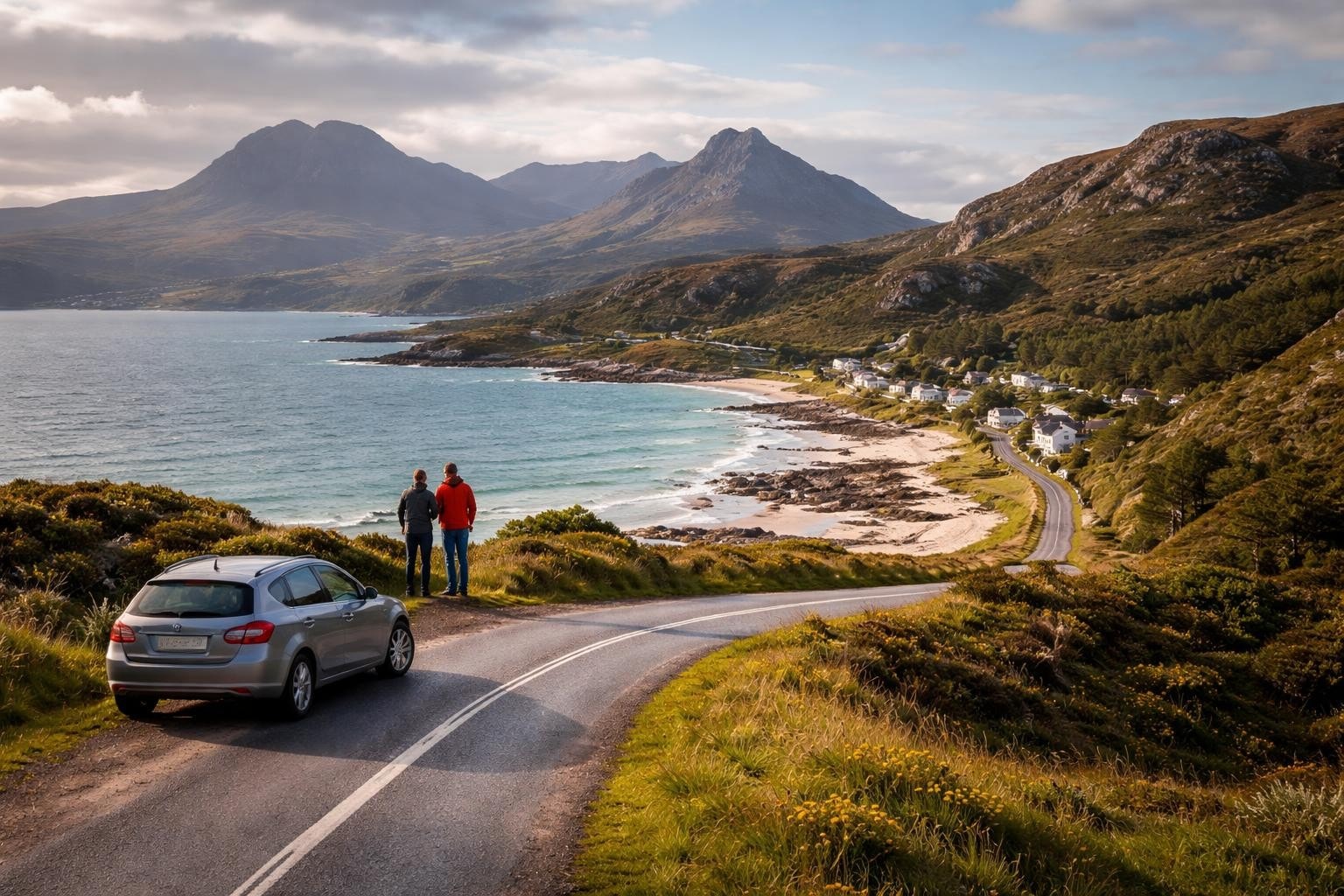
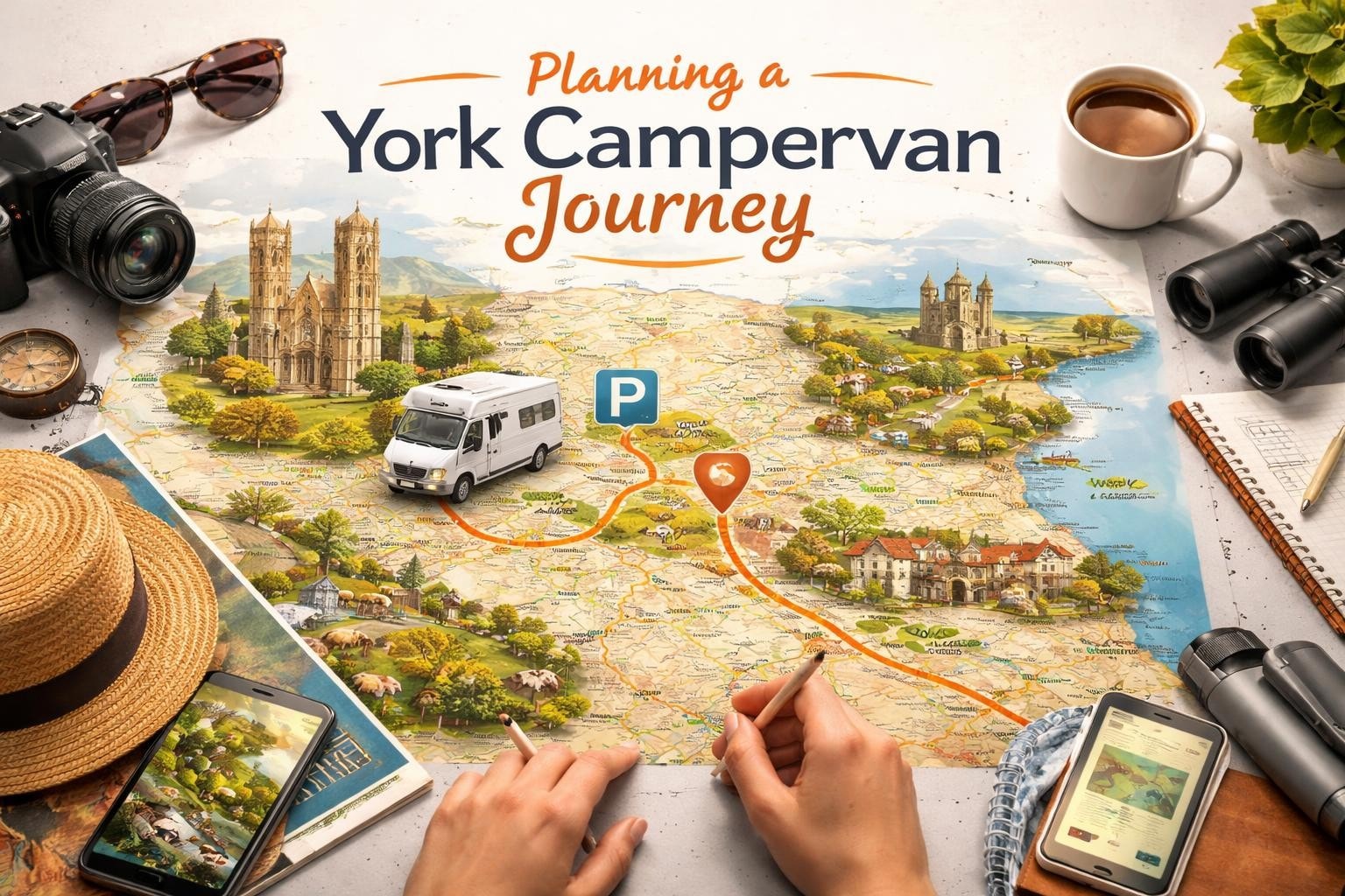
Planning a campervan adventure around Scotland's most spectacular coastal route requires more than just enthusiasm and a sense of adventure. The North Coast 500, often called Scotland's answer to Route 66, offers 516 miles of breathtaking scenery, historic castles, pristine beaches, and charming villages. Whether you're setting off from Leeds in a cosy 2-berth campervan or taking the whole family in a spacious motorhome, understanding how to navigate this iconic route is essential for an unforgettable journey.
The North Coast 500 begins and ends in Inverness, making a complete loop around the northern Highlands of Scotland. This circular route takes you through some of the most dramatic landscapes in Britain, from rugged coastlines to ancient forests and mountain passes.
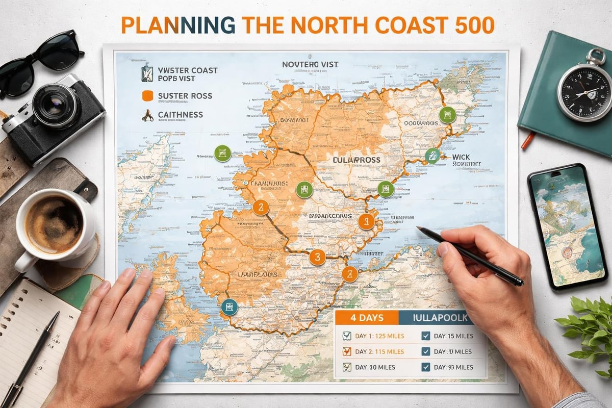
A proper north coast 500 map reveals the route's strategic layout through six distinct regions: Wester Ross, Sutherland, Caithness, the Black Isle, Easter Ross, and Inverness-shire. Each region offers its own character and attractions, making route planning crucial for maximizing your time.
Starting from Inverness, the traditional clockwise direction takes you first along the Black Isle, offering gentle introduction to Highland scenery. From there, you head north through Easter Ross before reaching the wild beauty of Sutherland's west coast.
The route then curves around through Caithness, the northeastern corner where the landscape opens into dramatic clifftops and sweeping moorland. Wester Ross on the western coast delivers the route's most dramatic scenery, with mountains plunging straight into the sea.
| Region | Key Characteristics | Recommended Time |
|---|---|---|
| Black Isle | Rolling farmland, dolphin watching | Half day |
| Easter Ross | Coastal villages, history | 1 day |
| Sutherland | Remote beaches, wildlife | 2-3 days |
| Caithness | Clifftops, John O'Groats | 1-2 days |
| Wester Ross | Mountain scenery, lochs | 2-3 days |
| Inverness-shire | Gateway region | Half day |
Different map formats serve different purposes when navigating Scotland's premier road trip route. Understanding which type works best for your travel style helps ensure smooth navigation through sometimes challenging Highland terrain.
The official North Coast 500 map provides comprehensive detail in a convenient A1 format that folds down to pocket size. This full-color resource includes tourist attractions, driving information, and crucially for motorhome drivers, alternative routes for larger vehicles.
Paper maps offer reliability when mobile signals drop, which happens frequently in the remote Highland regions. They also allow you to mark your own notes, campsite locations, and points of interest discovered along the way.
Modern GPS systems and smartphone apps provide real-time navigation, but they come with limitations in the Highlands. Mobile signal can be intermittent or non-existent for long stretches, particularly along the western coast through Wester Ross and northwestern Sutherland.
Advantages of digital maps:
Limitations to consider:
Before departing Leeds, spend time exploring the interactive route map available on the official North Coast 500 website. This digital tool lets you preview each section, research attractions, and plan overnight stops from the comfort of home.
These resources typically include photo galleries, attraction descriptions, and user reviews that help you prioritize which locations deserve more time. Building a preliminary itinerary using these tools means you arrive prepared, even if you maintain flexibility once on the road.
Effective route planning makes the difference between a stressed dash around Scotland and a relaxed exploration of its finest landscapes. Your north coast 500 map becomes the foundation for decisions about timing, overnight stops, and daily distances.
Most travelers choose the clockwise direction from Inverness, heading north up the east coast before sweeping around through Caithness and down the dramatic western seaboard. This approach saves the most spectacular coastal scenery for the second half of your journey.
The anticlockwise route tackles the challenging western mountain passes earlier in your trip. This option works well if you want dramatic scenery immediately, though it means ending your journey with the gentler eastern landscapes.
Clockwise advantages:
Anticlockwise considerations:
The total 516-mile distance seems manageable until you factor in the reality of Highland driving. Single-track roads, passing places, wandering sheep, and jaw-dropping scenery that demands photo stops mean average speeds rarely exceed 30-40 mph on many sections.
A good north coast 500 map helps you divide the route into realistic daily sections. Most motorhome travelers find 60-80 miles per day allows time for sightseeing, photography, and simply soaking in the atmosphere without feeling rushed.
| Journey Section | Distance | Typical Drive Time | Recommended Stops |
|---|---|---|---|
| Inverness to Ullapool | 58 miles | 2-3 hours | Corrieshalloch Gorge, Falls of Measach |
| Ullapool to Lochinver | 35 miles | 2 hours | Ardmair Beach, Knockan Crag |
| Lochinver to Durness | 70 miles | 3-4 hours | Achmelvich Beach, Drumbeg viewpoint |
| Durness to Thurso | 72 miles | 3-4 hours | Smoo Cave, Castle of Mey |
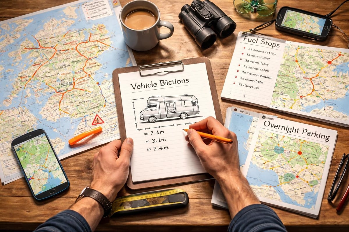
Driving a motorhome around the North Coast 500 presents unique challenges that require specific preparation beyond basic map reading. Understanding your vehicle dimensions and how they interact with Highland road conditions keeps you safe and confident.
Much of the route, particularly through Wester Ross and Sutherland, consists of single-track roads with passing places. Your north coast 500 map should indicate these sections, allowing you to mentally prepare for different driving conditions.
Key single-track principles:
Standard motorhomes fit through most routes, but some alternative roads have low bridges or narrow gates. Always check your vehicle height before departure and note any restrictions marked on detailed maps.
The comprehensive guide available from the official North Coast 500 organization includes specific advice for larger vehicles, helping you identify which alternative routes exist where the main coastal road becomes too challenging.
Your north coast 500 map helps identify potential overnight locations, but understanding the different options available helps you make informed choices about where to rest each evening.
The NC500 route passes numerous established campsites ranging from basic facilities to fully-serviced motorhome parks. Booking ahead during peak season (May through September) is essential, as spaces fill quickly.
Wild camping and overnight parking carry specific responsibilities in the Highlands. The Scottish Outdoor Access Code permits responsible wild camping, but this means leaving no trace and respecting local communities.
Always use designated motorhome parking areas where available. These locations typically offer waste disposal facilities and are situated where overnight parking doesn't impact local residents or businesses.
The time of year dramatically affects your North Coast 500 experience, influencing not just weather conditions but road accessibility, daylight hours, and facility availability. Consulting your north coast 500 map alongside seasonal guides helps set realistic expectations.
Spring offers longer daylight hours and fewer tourists, though weather remains unpredictable. Snow can still affect higher passes in March and early April, so check road conditions before tackling mountain routes.
Wildlife watching improves significantly in spring, with seal pups, nesting seabirds, and newborn Highland cattle calves appearing along the route. Your map can help you identify prime wildlife spotting locations.
Summer brings extended daylight, with the northern location meaning twilight lasts until nearly midnight in June. This allows flexible scheduling and the ability to drive later when roads are quieter.
However, summer also brings midges, particularly in sheltered areas during calm, humid conditions. Coastal locations with steady breezes offer relief, so plan your overnight stops strategically using your map to identify exposed sites.
Early autumn combines relatively stable weather with spectacular fall colors and significantly fewer tourists. The travel guide advice suggests September offers one of the best windows for motorhome exploration.
Facilities begin closing from mid-October onwards, so verify campsite opening dates before finalizing your itinerary. Your map becomes crucial for identifying which services remain available in shoulder season.
Remote Highland sections can stretch 40-50 miles between fuel stations, making fuel planning essential. A detailed north coast 500 map marked with service stations prevents range anxiety, particularly important when driving larger motorhomes with significant fuel consumption.
Western coast considerations:
The stretch from Ullapool to Durness includes limited fuel options, with Lochinver offering the main service station. Missing this means a potentially worrying drive to the next available fuel.
Northern section tips:
Fuel prices increase the further north you travel, with remote stations charging premium rates. Fill up when you see reasonable prices, particularly in larger towns like Ullapool or Thurso.
| Location | Last Fuel Before | Next Station | Distance |
|---|---|---|---|
| Ullapool | Heading north | Lochinver | 35 miles |
| Lochinver | Continuing north | Durness | 70 miles |
| Durness | Heading east | Tongue | 28 miles |
| John O'Groats | Heading south | Wick | 17 miles |
A north coast 500 map reveals dozens of attractions worth adding to your itinerary. Prioritizing based on your interests helps create a personalized journey rather than simply following the standard route.
Coastal attractions:
Mountain landscapes:
Scotland's turbulent history left impressive monuments scattered around the route. Mark these on your map to ensure you don't miss significant sites that align with your interests.
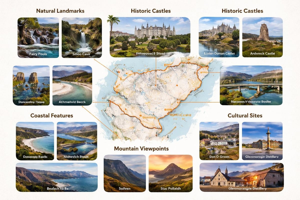
Notable castles and historic buildings:
Highland weather changes rapidly, with conditions varying dramatically between east and west coasts. Understanding how to read weather patterns in conjunction with your north coast 500 map helps you adapt plans for safety and comfort.
The western coast receives significantly more rainfall than eastern sections, with Wester Ross being particularly wet. Your map helps you plan activities accordingly, scheduling outdoor walks for drier eastern days while saving rainy periods for driving spectacular western coastal roads.
Wind exposure varies considerably too. Coastal sections experience stronger winds than inland glens, affecting both driving comfort and campsite selection. Choose your overnight stops based on forecast conditions rather than just map location.
Before departing from Leeds, ensure your motorhome is properly equipped for Highland conditions. While your north coast 500 map guides where you're going, vehicle preparation ensures you arrive safely and comfortably.
Navigation backup:
Safety equipment:
Comfort additions:
The comprehensive planning resources available through the official route website complement your physical map, offering downloadable guides and current condition updates that inform your preparation.
The North Coast 500 rewards flexible planning over rigid schedules. While your north coast 500 map provides the framework, allowing time for spontaneous detours and unexpected discoveries creates the most memorable experiences.
Plan shorter daily distances than you think necessary. Highland roads invite slower travel, with viewpoints, wildlife encounters, and friendly locals all providing reasons to pause. Motorhome travel offers the luxury of stopping wherever captures your imagination.
Consider planning loop walks from roadside parking areas, exploring coastal paths, or simply sitting by a loch watching the light change across the mountains. These unplanned moments often become journey highlights.
The Highlands rely on tourism but value respectful visitors who engage thoughtfully with local communities. Support local businesses, follow the Scottish Outdoor Access Code, and take time to chat with residents who often share valuable local knowledge.
Small cafes, craft shops, and local museums scattered along the route provide authentic Highland experiences beyond the major attractions marked on tourist maps. These encounters add depth to your journey, transforming it from a simple road trip into genuine cultural exploration.
Modern technology enhances rather than replaces traditional map reading. The most successful North Coast 500 journeys combine both approaches, using each method's strengths while acknowledging their limitations.
Download offline maps before departure, ensuring navigation continues through signal-free zones. However, keep your paper north coast 500 map accessible for quick overview reference and marking locations that exceed your expectations.
Apps like Park4Night help identify motorhome-friendly overnight spots, while dedicated NC500 apps provide curated attraction information. These digital tools work best when used alongside your physical map, creating comprehensive awareness of both your current location and upcoming opportunities.
Exploring the detailed route sections and understanding vehicle options helps you match motorhome size to route challenges, ensuring comfortable navigation throughout your Highland adventure.
Planning your North Coast 500 adventure with a comprehensive map transforms this spectacular route from a simple drive into a carefully crafted exploration of Scotland's finest landscapes. Whether you're ready to set off immediately or still in the dreaming stage, having the right vehicle makes all the difference to your Highland experience. The Camper Co offers a range of motorhomes and campervans perfectly suited for tackling Scotland's most famous road trip, from compact 2-berth options ideal for couples to spacious family motorhomes that bring everyone along for the adventure.